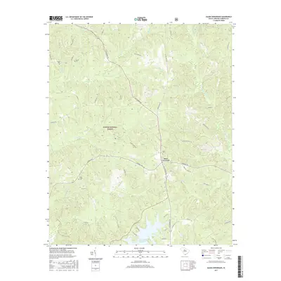
2017 Map of Salem Crossroads
USGS Topo · Published 2017About this map
Salem Crossroads serves as a central junction within the Fairfield County landscape, where the Catawba Trail and Old Cherokee Rd converge amidst the dense woodlands of the Sumter National Forest. The map documents a rural environment defined by winding waterways like Chicken Cr and the W Fork Little River, which feed into the large Monticello Reservoir to the south.
Find a feature on this map
53 named features on this map. Tap any name to fly to it.
Don’t see what you’re looking for? This feature index may not catch every label — zoom into the map to look around manually.
Map Details
Editions of this 2017 Salem Crossroads Map
This is the sole edition of this map. No revisions or reprints were ever made.
Other maps of this area

1904 · Columbia
USGS Topo · 1:125,000

1941 · Spartanburg
USGS Topo · 1:250,000

1953 · Spartanburg
USGS Topo · 1:250,000

1960 · Spartanburg
USGS Topo · 1:250,000

1963 · Spartanburg
USGS Topo · 1:250,000

1964 · Spartanburg
USGS Topo · 1:250,000

1968 · Blackstock
USGS Topo · 1:24,000

1969 · Lebanon
USGS Topo · 1:24,000

1969 · Pomaria
USGS Topo · 1:24,000

1969 · Blair
USGS Topo · 1:24,000