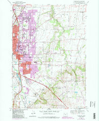
1969 Map of Salem East
USGS Topo · Published 1987About this map
Salem's eastern expansion into the agricultural landscape of Howell Prairie is captured here during a period of significant mid-century growth. The map illustrates a dense concentration of state institutions along the city's edge, including the Oregon State Penitentiary, State Hospital, and the Oregon Correctional Institution. Beyond the urban core, the landscape transitions into a network of small rural settlements like Pratum and Macleay, which are connected by the Southern Pacific railroad line.
Find a feature on this map
61 named features on this map. Tap any name to fly to it.
Don’t see what you’re looking for? This feature index may not catch every label — zoom into the map to look around manually.
Map Details
Editions of this 1969 Salem East Map
4 editions found
Other maps of this area

1915 · Eola
USGS Topo · 1:31,680

1915 · Sidney
USGS Topo · 1:31,680

1917 · Salem
USGS Topo · 1:62,500

1923 · Mount Angel
USGS Topo · 1:62,500

1924 · Mc Minnville
USGS Topo · 1:48,000

1925 · Stayton
USGS Topo · 1:62,500

1926 · Mc Minnville
USGS Topo · 1:62,500

1940 · McMinnville
USGS Topo · 1:62,500

1940 · Salem
USGS Topo · 1:62,500

1940 · Mount Angel
USGS Topo · 1:62,500