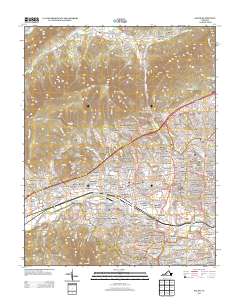
2013 Map of Salem
USGS Topo · Published 2013About this map
Salem serves as the focal point of this 2013 survey, where the valley floor meets the rising slopes of Little Brushy Mountain and the prominent landmark of Hanging Rock. This era shows a densely settled landscape defined by numerous distinct residential neighborhoods and institutional grounds, including the Virginia Baptist Childrens Home and the Southern Lutheran Orphanage. The transport network is anchored by the Norfolk Southern rail line and the presence of the Trussmark Airport, reflecting the area's role as a regional hub.
Find a feature on this map
428 named features on this map. Tap any name to fly to it.
Don’t see what you’re looking for? This feature index may not catch every label — zoom into the map to look around manually.
Map Details
Editions of this 2013 Salem Map
This is the sole edition of this map. No revisions or reprints were ever made.
Other maps of this area

1890 · Roanoke
USGS Topo · 1:125,000

1890 · Christiansburg
USGS Topo · 1:125,000

1891 · Roanoke
USGS Topo · 1:125,000

1929 · Roanoke
USGS Topo · 1:48,000

1929 · Salem
USGS Topo · 1:48,000

1932 · Salem
USGS Topo · 1:62,500

1933 · Roanoke
USGS Topo · 1:62,500

1947 · Roanoke
USGS Topo · 1:250,000

1950 · Elliston
USGS Topo · 1:62,500

1951 · Boones Mill
USGS Topo · 1:62,500