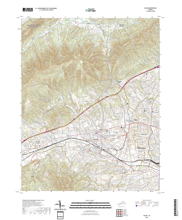
2022 Map of Salem
USGS Topo · Published 2022About this map
Salem serves as a major hub where the Roanoke River meets the valley floor, flanked by the massive heights of Ft Lewis Mtn and Catawba Mtn. This modern survey reveals a landscape defined by civic and educational institutions, including the historic Roanoke College and both the Salem City Courthouse and Roanoke County Courthouse. The suburban expansion between Salem and Roanoke is clearly visible in the residential grids of Edgewood and Sunset Village, while the northern reaches maintain a more rural character around Mason Cove and Bennett Springs.
Find a feature on this map
280 named features on this map. Tap any name to fly to it.
Don’t see what you’re looking for? This feature index may not catch every label — zoom into the map to look around manually.
Map Details
Editions of this 2022 Salem Map
This is the sole edition of this map. No revisions or reprints were ever made.
Other maps of this area

1890 · Roanoke
USGS Topo · 1:125,000

1890 · Christiansburg
USGS Topo · 1:125,000

1891 · Roanoke
USGS Topo · 1:125,000

1929 · Roanoke
USGS Topo · 1:48,000

1929 · Salem
USGS Topo · 1:48,000

1932 · Salem
USGS Topo · 1:62,500

1933 · Roanoke
USGS Topo · 1:62,500

1947 · Roanoke
USGS Topo · 1:250,000

1950 · Elliston
USGS Topo · 1:62,500

1951 · Boones Mill
USGS Topo · 1:62,500