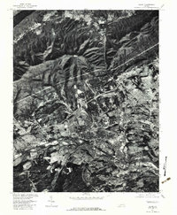
1977 Map of Salem
USGS Topo · Published 1983About this map
The Salem and Roanoke corridor is captured here during a period of significant mid-century expansion, where the urban landscape meets the dramatic slopes of Fort Lewis Mountain. This orthophotoquad, derived from 1977 aerial imagery, reveals the precise footprint of residential and industrial development along the Roanoke River. To the north, the terrain rises sharply toward Brushy Mountain, where smaller communities like Mason Cove and Bennett Springs occupy the valleys between ridges. The inclusion of landmark locations like Hanging Rock provides a clear perspective on how the regional transportation network and suburban neighborhoods such as Beverly Heights were integrated into the narrow river valley and surrounding foothills before the close of the 1970s.
Find a feature on this map
12 named features on this map. Tap any name to fly to it.
Don’t see what you’re looking for? This feature index may not catch every label — zoom into the map to look around manually.
Map Details
Editions of this 1977 Salem Map
This is the sole edition of this map. No revisions or reprints were ever made.
Other maps of this area

1890 · Roanoke
USGS Topo · 1:125,000

1890 · Christiansburg
USGS Topo · 1:125,000

1891 · Roanoke
USGS Topo · 1:125,000

1929 · Roanoke
USGS Topo · 1:48,000

1929 · Salem
USGS Topo · 1:48,000

1932 · Salem
USGS Topo · 1:62,500

1933 · Roanoke
USGS Topo · 1:62,500

1947 · Roanoke
USGS Topo · 1:250,000

1950 · Elliston
USGS Topo · 1:62,500

1951 · Boones Mill
USGS Topo · 1:62,500