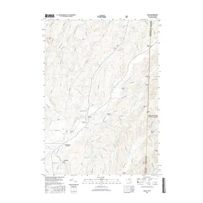
2016 Map of Salem
USGS Topo · Published 2016About this map
Salem serves as the focal point of this Washington County landscape, situated where White Cr meets the drainage of Buttermilk Falls Brook. The village layout is preserved alongside significant local heritage sites, including the Revolutionary War Cem and Evergreen Cem. To the south, the settlement of Rexleigh is home to the notable Rexleigh Bridge, while Greenwich Junction indicates the historical importance of rail connectivity in this corridor. The topography is defined by the transition from the valley floor to the prominent heights of Hebron Mtn in the northwest and the Green Mountain National Forest along the Vermont border to the east. Valleys like Perkins Hollow and Camden Valley cut through the high ground, while numerous family-named cemeteries such as Cleveland Cem and Parish Cem offer valuable points of interest for genealogists and local historians studying the rural settlement patterns of the New York-Vermont state line.
Find a feature on this map
89 named features on this map. Tap any name to fly to it.
Don’t see what you’re looking for? This feature index may not catch every label — zoom into the map to look around manually.
Map Details
Editions of this 2016 Salem Map
This is the sole edition of this map. No revisions or reprints were ever made.
Other maps of this area

1893 · Fort Ann
USGS Topo · 1:62,500

1894 · Pawlet
USGS Topo · 1:62,500

1894 · Equinox
USGS Topo · 1:62,500

1895 · Cambridge
USGS Topo · 1:62,500

1895 · Fort Ann
USGS Topo · 1:62,500

1896 · Equinox
USGS Topo · 1:62,500

1897 · Pawlet
USGS Topo · 1:62,500

1898 · Cambridge
USGS Topo · 1:62,500

1898 · Fort Ann
USGS Topo · 1:62,500

1900 · Equinox
USGS Topo · 1:62,500