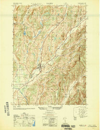
1950 Map of Salem
USGS Topo · Published 1951About this map
The town of Salem serves as the central hub of this 1950s study, where the Delaware and Hudson railroad tracks cut a diagonal path through the valley. The map documents a landscape of established rural communities and family heritage, evidenced by several significant burial grounds including Evergreen Cem and Catholic Cem. Along the southern edge, the Batten Kill river winds past the small settlement of Rexleigh, illustrating the historical importance of water power and transport in Washington County.
Find a feature on this map
28 named features on this map. Tap any name to fly to it.
Don’t see what you’re looking for? This feature index may not catch every label — zoom into the map to look around manually.
Map Details
Editions of this 1950 Salem Map
This is the sole edition of this map. No revisions or reprints were ever made.
Other maps of this area

1893 · Fort Ann
USGS Topo · 1:62,500

1894 · Pawlet
USGS Topo · 1:62,500

1894 · Equinox
USGS Topo · 1:62,500

1895 · Cambridge
USGS Topo · 1:62,500

1895 · Fort Ann
USGS Topo · 1:62,500

1896 · Equinox
USGS Topo · 1:62,500

1897 · Pawlet
USGS Topo · 1:62,500

1898 · Cambridge
USGS Topo · 1:62,500

1898 · Fort Ann
USGS Topo · 1:62,500

1900 · Equinox
USGS Topo · 1:62,500