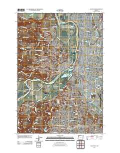
2011 Map of Salem West
USGS Topo · Published 2011About this map
The Willamette River bisects the landscape of the state capital, separating the core of Salem from West Salem as the city expanded in the early 21st century. The east bank is densely marked by civic and educational institutions, including the campus of Willamette University and the Oregon State Penitentiary. A significant concentration of burial sites, such as Lee Mission Cemetery, Pioneer Cemetery, and City View Cemetery, provides a wealth of data for local genealogy and land-use studies. To the south and west, the terrain rises toward Illahe Hill and Croisan Ridge, while the river's floodplain is dominated by the sprawling Minto Brown Island Park. This detailed study also captures the development of residential pockets like Salemtowne and the rural-to-suburban transition at Grabenhorst Corner and Liberty.
Find a feature on this map
140 named features on this map. Tap any name to fly to it.
Don’t see what you’re looking for? This feature index may not catch every label — zoom into the map to look around manually.
Map Details
Editions of this 2011 Salem West Map
This is the sole edition of this map. No revisions or reprints were ever made.
Other maps of this area

1914 · Independence
USGS Topo · 1:31,680

1915 · Rickreall
USGS Topo · 1:31,680

1915 · Eola
USGS Topo · 1:31,680

1915 · Sidney
USGS Topo · 1:31,680

1917 · Salem
USGS Topo · 1:62,500

1923 · Mount Angel
USGS Topo · 1:62,500

1924 · Mc Minnville
USGS Topo · 1:48,000

1925 · Stayton
USGS Topo · 1:62,500

1926 · Mc Minnville
USGS Topo · 1:62,500

1940 · McMinnville
USGS Topo · 1:62,500