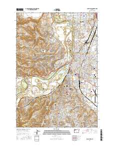
2017 Map of Salem West
USGS Topo · Published 2017About this map
The Willamette River divides the landscape, separating West Salem in Polk County from the state capital and its northern neighbor, Keizer, in Marion County. This recent survey captures the dense urban and suburban layout of the valley, where landmarks like Willamette University and McNary Field anchor the community's civic and academic life. The terrain varies from the flat riverine environment of Minto Island and Browns Island to the rising elevations of the Salem Hills and Eola Hills. For researchers, the map provides precise locations for several major burial grounds, including the Lee Mission Cemetery and City View Cemetery. The industrial and transportation history of the region is evident in the Burlington Northern railroad corridor and the former extraction site at Stone Quarry Lake, reflecting a long-standing reliance on the river and rail network for commerce.
Find a feature on this map
67 named features on this map. Tap any name to fly to it.
Don’t see what you’re looking for? This feature index may not catch every label — zoom into the map to look around manually.
Map Details
Editions of this 2017 Salem West Map
This is the sole edition of this map. No revisions or reprints were ever made.
Other maps of this area

1914 · Independence
USGS Topo · 1:31,680

1915 · Rickreall
USGS Topo · 1:31,680

1915 · Eola
USGS Topo · 1:31,680

1915 · Sidney
USGS Topo · 1:31,680

1917 · Salem
USGS Topo · 1:62,500

1923 · Mount Angel
USGS Topo · 1:62,500

1924 · Mc Minnville
USGS Topo · 1:48,000

1925 · Stayton
USGS Topo · 1:62,500

1926 · Mc Minnville
USGS Topo · 1:62,500

1940 · McMinnville
USGS Topo · 1:62,500