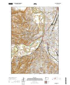
2020 Map of Salem West
USGS Topo · Published 2020About this map
The Willamette River carves a deep path through the heart of this region, separating the residential expansions of West Salem from the civic core of Salem. In the early 21st century, the landscape reflects a dense urban grid balanced against the riparian lowlands of Minto Island and Browns Island. The eastern bank serves as the seat of government, housing the Marion County Courthouse and the Supreme Court of the State of Oregon, while the campus of Willamette University anchors the historic downtown district.
Find a feature on this map
216 named features on this map. Tap any name to fly to it.
Don’t see what you’re looking for? This feature index may not catch every label — zoom into the map to look around manually.
Map Details
Editions of this 2020 Salem West Map
This is the sole edition of this map. No revisions or reprints were ever made.
Other maps of this area

1914 · Independence
USGS Topo · 1:31,680

1915 · Rickreall
USGS Topo · 1:31,680

1915 · Eola
USGS Topo · 1:31,680

1915 · Sidney
USGS Topo · 1:31,680

1917 · Salem
USGS Topo · 1:62,500

1923 · Mount Angel
USGS Topo · 1:62,500

1924 · Mc Minnville
USGS Topo · 1:48,000

1925 · Stayton
USGS Topo · 1:62,500

1926 · Mc Minnville
USGS Topo · 1:62,500

1940 · McMinnville
USGS Topo · 1:62,500