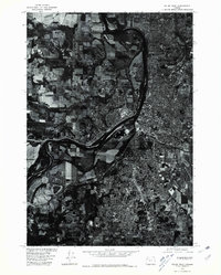
1975 Map of Salem West
USGS Topo · Published 1980About this map
The urban sprawl and industrial development of Salem are captured in high detail on this 1975 orthophotomap. The imagery, prepared in cooperation with the Soil Conservation Service, reveals the intricate relationship between the city's built environment and the sinuous path of the Willamette River as it flows through the valley. While much of the eastern portion of the sheet is dominated by the dense street grids of the state capital, the southern reaches show the emerging residential patterns around Liberty. The transition from urban center to organized agricultural fields and woodlots is clearly visible, providing researchers with a precise visual record of land use and development during the mid-1970s. This specific survey serves as a vital bridge for understanding the transition of the Marion County landscape before the further expansions of the late 20th century.
Find a feature on this map
2 named features on this map. Tap any name to fly to it.
Don’t see what you’re looking for? This feature index may not catch every label — zoom into the map to look around manually.
Map Details
Editions of this 1975 Salem West Map
This is the sole edition of this map. No revisions or reprints were ever made.
Other maps of this area

1914 · Independence
USGS Topo · 1:31,680

1915 · Rickreall
USGS Topo · 1:31,680

1915 · Eola
USGS Topo · 1:31,680

1915 · Sidney
USGS Topo · 1:31,680

1917 · Salem
USGS Topo · 1:62,500

1923 · Mount Angel
USGS Topo · 1:62,500

1924 · Mc Minnville
USGS Topo · 1:48,000

1925 · Stayton
USGS Topo · 1:62,500

1926 · Mc Minnville
USGS Topo · 1:62,500

1940 · McMinnville
USGS Topo · 1:62,500