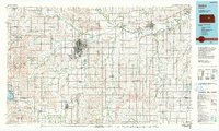
1990 Map of Salina
USGS Topo · Published 1990About this map
Salina serves as the primary hub of this north-central Kansas landscape, where the Smoky Hill River meets the Saline River and Solomon River. The city's mid-century growth is evident through established institutions like Marymount College and the Salina Municipal Airport, while the nearby Swedish heritage of Lindsborg is anchored by Bethany College. The regional connectivity is defined by the intersection of Interstate 70 and Interstate 135, which follow the paths of legacy rail lines including the Union Pacific RR and the Atchison Topeka and Santa Fe RR.
Find a feature on this map
138 named features on this map. Tap any name to fly to it.
Don’t see what you’re looking for? This feature index may not catch every label — zoom into the map to look around manually.
Map Details
Editions of this 1990 Salina Map
This is the sole edition of this map. No revisions or reprints were ever made.
Other maps of this area

1886 · Junction City
USGS Topo · 1:125,000

1889 · Newton
USGS Topo · 1:125,000

1889 · Junction City
USGS Topo · 1:125,000

1889 · Abilene
USGS Topo · 1:125,000

1889 · Parkerville
USGS Topo · 1:125,000

1891 · Hutchinson
USGS Topo · 1:125,000

1891 · Clay Center
USGS Topo · 1:125,000

1892 · Salina
USGS Topo · 1:125,000

1892 · Minneapolis
USGS Topo · 1:125,000

1893 · Hutchinson
USGS Topo · 1:125,000