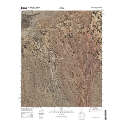
2013 Map of Salinas Peak NW
USGS Topo · Published 2013About this map
The arid landscape of the Jornada del Muerto dominates this 2013 survey, capturing the remote expanse where Socorro County and Sierra County meet. This portion of the historic desert basin, known as the "Journey of the Dead Man," reveals a sparse network of ranching outposts and essential water sources characteristic of the region's cattle industry. Small, named settlements like Chavez Ranch and Jac Ranch are positioned against the undulating terrain, which is carefully marked by elevation contours. Vital water infrastructure for these remote operations is documented through points such as Anderson Tank and Broke Tank, which provide crucial staging areas for livestock in this high-altitude basin. The map illustrates the fundamental relationship between water access and land use in one of New Mexico's most challenging environments.
Find a feature on this map
13 named features on this map. Tap any name to fly to it.
Don’t see what you’re looking for? This feature index may not catch every label — zoom into the map to look around manually.
Map Details
Editions of this 2013 Salinas Peak NW Map
This is the sole edition of this map. No revisions or reprints were ever made.
Other maps of this area

1916 · Salinas Peak
USGS Topo · 1:125,000

1948 · Granjean Well
USGS Topo · 1:62,500

1948 · Val Verde
USGS Topo · 1:62,500

1948 · Malpais Well
USGS Topo · 1:62,500

1948 · Salinas Peak
USGS Topo · 1:62,500

1954 · Tularosa
USGS Topo · 1:250,000

1958 · Tularosa
USGS Topo · 1:250,000

1981 · Big Gyp Mountain
USGS Topo · 1:24,000

1981 · Fairview Mountain
USGS Topo · 1:24,000
1981 · Salinas Peak
USGS Topo · 1:24,000