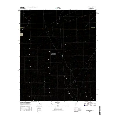
2017 Map of Salinas Peak NW
USGS Topo · Published 2017About this map
Harriet Ranch and Fuller Ranch anchor this arid landscape along the border of Socorro and Sierra Counties. The terrain is defined by isolated water sources such as Anderson Tank and Broke Tank, which were essential for ranching operations in this high-desert environment. A few named wells, including Blakemore Well and Foster Well, further illustrate the vital importance of groundwater management in the region. The topography rises toward prominent natural features including Salinas Peak, Big Gyp Mountain, and Fairview Mountain, while Fence Canyon cuts through the shifting elevations. Transportation in this portion of the basin is limited to utilitarian routes like Fuller Rd and the military-associated WSMR P Route 5, reflecting the controlled and pastoral nature of the land during this modern period.
Find a feature on this map
20 named features on this map. Tap any name to fly to it.
Don’t see what you’re looking for? This feature index may not catch every label — zoom into the map to look around manually.
Map Details
Editions of this 2017 Salinas Peak NW Map
This is the sole edition of this map. No revisions or reprints were ever made.
Other maps of this area

1916 · Salinas Peak
USGS Topo · 1:125,000

1948 · Granjean Well
USGS Topo · 1:62,500

1948 · Val Verde
USGS Topo · 1:62,500

1948 · Malpais Well
USGS Topo · 1:62,500

1948 · Salinas Peak
USGS Topo · 1:62,500

1954 · Tularosa
USGS Topo · 1:250,000

1958 · Tularosa
USGS Topo · 1:250,000

1981 · Big Gyp Mountain
USGS Topo · 1:24,000

1981 · Fairview Mountain
USGS Topo · 1:24,000
1981 · Salinas Peak
USGS Topo · 1:24,000