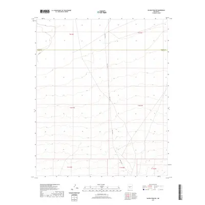
2020 Map of Salinas Peak NW
USGS Topo · Published 2020About this map
High desert terrain defines this landscape along the border of Socorro and Sierra counties in New Mexico. The area is characterized by vast open stretches of public land, with few man-made landmarks interrupting the natural topography. Fuller Rd provides limited access into this region, which relies on vital water sources like Anderson Tank for local utility in an otherwise arid environment. This 2020 survey illustrates the transition from the T9S to T11S townships, highlighting the expansive and undeveloped nature of the White Sands Missile Range periphery. The terrain is marked by gentle contouring and natural drainage patterns, representative of the high-altitude basin and range geography typical of this part of the state.
Find a feature on this map
10 named features on this map. Tap any name to fly to it.
Don’t see what you’re looking for? This feature index may not catch every label — zoom into the map to look around manually.
Map Details
Editions of this 2020 Salinas Peak NW Map
This is the sole edition of this map. No revisions or reprints were ever made.
Other maps of this area

1916 · Salinas Peak
USGS Topo · 1:125,000

1948 · Granjean Well
USGS Topo · 1:62,500

1948 · Val Verde
USGS Topo · 1:62,500

1948 · Malpais Well
USGS Topo · 1:62,500

1948 · Salinas Peak
USGS Topo · 1:62,500

1954 · Tularosa
USGS Topo · 1:250,000

1958 · Tularosa
USGS Topo · 1:250,000

1981 · Big Gyp Mountain
USGS Topo · 1:24,000

1981 · Fairview Mountain
USGS Topo · 1:24,000
1981 · Salinas Peak
USGS Topo · 1:24,000