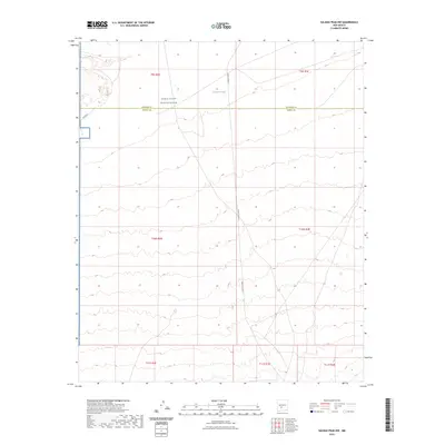
2023 Map of Salinas Peak NW
USGS Topo · Published 2023About this map
White Sands Missile Range dominates this high-desert landscape in central New Mexico, where the remote terrain is defined by military activity and sparse infrastructure. The map reveals a land primarily managed for federal testing, with the boundary between Socorro Co and Sierra Co cutting through the northern section. Water sources are extremely rare in this arid environment, making Anderson Tank a critical landmark for the area. Movement through this high-altitude basin is restricted to a few established paths, including Fuller Rd and the internal military roadway Wsmr P Route S, illustrating the specialized use of this territory during the early twenty-first century. The grid layout of the Public Land Survey System provides the primary structural framework for navigating this largely unsettled expanse of southern Socorro and northern Sierra counties.
Find a feature on this map
12 named features on this map. Tap any name to fly to it.
Don’t see what you’re looking for? This feature index may not catch every label — zoom into the map to look around manually.
Map Details
Editions of this 2023 Salinas Peak NW Map
This is the sole edition of this map. No revisions or reprints were ever made.
Other maps of this area

1916 · Salinas Peak
USGS Topo · 1:125,000

1948 · Granjean Well
USGS Topo · 1:62,500

1948 · Val Verde
USGS Topo · 1:62,500

1948 · Malpais Well
USGS Topo · 1:62,500

1948 · Salinas Peak
USGS Topo · 1:62,500

1954 · Tularosa
USGS Topo · 1:250,000

1958 · Tularosa
USGS Topo · 1:250,000

1981 · Big Gyp Mountain
USGS Topo · 1:24,000

1981 · Fairview Mountain
USGS Topo · 1:24,000
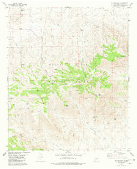
1981 · Salinas Peak
USGS Topo · 1:24,000