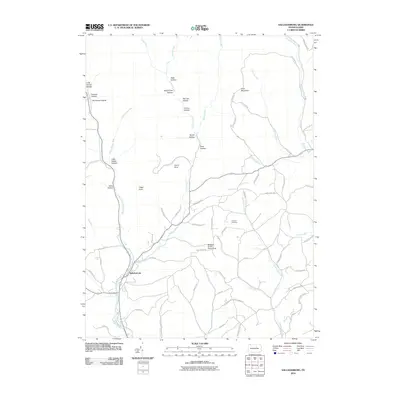
2010 Map of Salladasburg
USGS Topo · Published 2010About this map
Salladasburg serves as the primary settlement center in this portion of Lycoming County, situated at the confluence of several vital watercourses including Larrys Creek and Joes Run. The landscape is defined by a dense network of hollows and ridges, with family and local history tied to named landforms like Watt Hollow, De France Hollow, and Pot Lick Hollow. The presence of Coal Mountain and Coal Mine Rd in the northeast suggests the area's geological and industrial heritage, while the Anthony Cemetery and Stablers Grove Picnic Area mark the community's social and memorial spaces. Transportation through the winding terrain is facilitated by a complex web of rural routes such as Windy Ridge Rd and Chestnut Ridge Rd, tracing the high ground between drainage basins like Hoagland Run and Quenshukeny Run.
Find a feature on this map
66 named features on this map. Tap any name to fly to it.
Don’t see what you’re looking for? This feature index may not catch every label — zoom into the map to look around manually.
Map Details
Editions of this 2010 Salladasburg Map
This is the sole edition of this map. No revisions or reprints were ever made.
Other maps of this area

1921 · Williamsport
USGS Topo · 1:48,000

1921 · Trout Run
USGS Topo · 1:62,500

1921 · Lock Haven
USGS Topo · 1:62,500

1923 · Lock Haven
USGS Topo · 1:62,500

1923 · Trout Run
USGS Topo · 1:62,500

1923 · Williamsport
USGS Topo · 1:62,500

1935 · Waterville
USGS Topo · 1:24,000

1937 · Waterville
USGS Topo · 1:48,000

1943 · Waterville
USGS Topo · 1:62,500

1944 · Trout Run
USGS Topo · 1:62,500