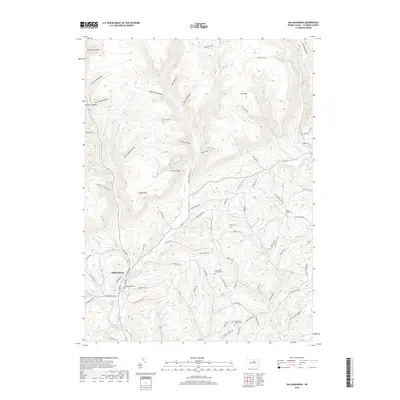
2019 Map of Salladasburg
USGS Topo · Published 2019About this map
Salladasburg sits at the confluence of several mountain streams in Lycoming County, where the First Fork Larrys Cr joins Larrys Creek. This 2019 survey illustrates a landscape defined by deep valleys and sharp ridges, including Coal Mtn and the curious topographic naming of Spook Hollow and Match Pine Hollow. The area maintains a high density of small township burial grounds and family-named landmarks, reflecting generations of local settlement and land use. Genealogists will find a clear index of these locations, from the Salladasburg Cem in town to the more remote Woodward Township Cem and State Road Cem. The drainage pattern of Second Fork Larrys Cr and its numerous tributaries like Joes Run and Lick Run dictates the winding path of modern roads such as W State Rte 973, following the natural contours of the Central Pennsylvania terrain.
Find a feature on this map
84 named features on this map. Tap any name to fly to it.
Don’t see what you’re looking for? This feature index may not catch every label — zoom into the map to look around manually.
Map Details
Editions of this 2019 Salladasburg Map
This is the sole edition of this map. No revisions or reprints were ever made.
Other maps of this area

1921 · Williamsport
USGS Topo · 1:48,000

1921 · Trout Run
USGS Topo · 1:62,500

1921 · Lock Haven
USGS Topo · 1:62,500

1923 · Lock Haven
USGS Topo · 1:62,500

1923 · Trout Run
USGS Topo · 1:62,500

1923 · Williamsport
USGS Topo · 1:62,500

1935 · Waterville
USGS Topo · 1:24,000

1937 · Waterville
USGS Topo · 1:48,000

1943 · Waterville
USGS Topo · 1:62,500

1944 · Trout Run
USGS Topo · 1:62,500