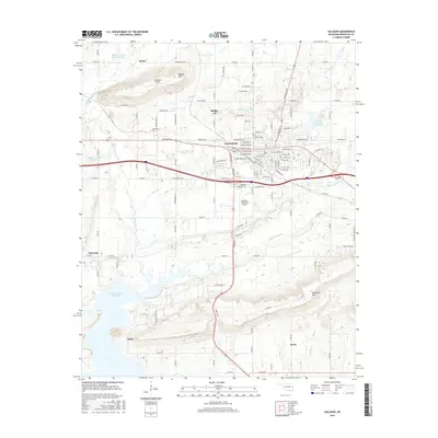
2016 Map of Sallisaw
USGS Topo · Published 2016About this map
Sallisaw serves as the focal point of this Eastern Oklahoma landscape, situated where the Arkansas River valley begins to meet the foothills of the Ozarks. The town's grid is dense with residential streets and local landmarks, including the Sallisaw Cem and Sallisaw Municipal Airport. To the south, the massive Robert S Kerr Reservoir dominates the terrain, creating a complex shoreline near the settlements of Sadie and Brent.
Find a feature on this map
118 named features on this map. Tap any name to fly to it.
Don’t see what you’re looking for? This feature index may not catch every label — zoom into the map to look around manually.
Map Details
Editions of this 2016 Sallisaw Map
This is the sole edition of this map. No revisions or reprints were ever made.
Other maps of this area

1898 · Tahlequah
USGS Topo · 1:125,000

1900 · Sallisaw
USGS Topo · 1:125,000

1901 · Tahlequah
USGS Topo · 1:125,000

1905 · Tahlequah
USGS Topo · 1:125,000

1911 · Sallisaw
USGS Topo · 1:125,000

1946 · Fort Smith
USGS Topo · 1:250,000

1965 · Fort Smith
USGS Topo · 1:250,000

1966 · Gans
USGS Topo · 1:24,000

1966 · Muldrow SW
USGS Topo · 1:24,000

1967 · Fort Smith
USGS Topo · 1:250,000