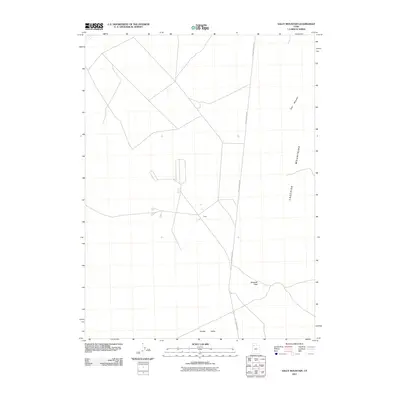
2011 Map of Sally Mountain
USGS Topo · Published 2011About this map
Hill Air Force Base land occupies a significant portion of this high desert landscape, highlighting the military's footprint in Box Elder County. The remote character of the area is anchored by the small settlement of Oasis, positioned between the broad expanse of Puddle Valley and the rising elevations of the Lakeside Mountains. A network of unpaved roads and tracks crisscrosses the flats, converging near several landing strips and specialized facilities that reflect the region's mid-century and modern role in aerospace and defense testing. Topographical features like Sally Mountain and the natural corridor of Wrathall Pass break the flat basin floor, offering critical geographic context for those studying the intersection of public land, military reservations, and the sparsely populated interior of northern Utah.
Find a feature on this map
6 named features on this map. Tap any name to fly to it.
Don’t see what you’re looking for? This feature index may not catch every label — zoom into the map to look around manually.
Map Details
Editions of this 2011 Sally Mountain Map
This is the sole edition of this map. No revisions or reprints were ever made.
Other maps of this area

1885 · Tooele Valley
USGS Topo · 1:250,000

1953 · Tooele
USGS Topo · 1:250,000

1954 · Brigham City
USGS Topo · 1:250,000

1955 · Tooele
USGS Topo · 1:250,000

1958 · Brigham City
USGS Topo · 1:250,000

1962 · Brigham City
USGS Topo · 1:250,000

1968 · Deardens Knoll
USGS Topo · 1:24,000

1968 · Craner Peak
USGS Topo · 1:24,000

1969 · Hogup Ridge South
USGS Topo · 1:24,000

1969 · Strongs Knob
USGS Topo · 1:24,000