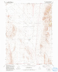
1991 Map of Sally Mountain
USGS Topo · Published 1991About this map
The Utah Test and Training Range North dominates this landscape along the border of Box Elder and Tooele Counties, representing a specialized military and industrial footprint in the Great Salt Lake Desert. The map reveals the infrastructure required for high-stakes operations, including several Heliports and a remote outpost at Oasis. This functional landscape is defined by the stark transition from the floor of Puddle Valley to the steep eastern rise of the Lakeside Mountains. Scattered Gravel Pits and a Borrow Pit indicate the material extraction necessary to maintain the remote roads and facilities here. Further north, the presence of a Guzzler and an Aqueduct highlights the critical importance of water management in this arid environment, while Wrathall Pass provides a key point of transit through the mountain range.
Find a feature on this map
17 named features on this map. Tap any name to fly to it.
Don’t see what you’re looking for? This feature index may not catch every label — zoom into the map to look around manually.
Map Details
Editions of this 1991 Sally Mountain Map
This is the sole edition of this map. No revisions or reprints were ever made.
Other maps of this area

1885 · Tooele Valley
USGS Topo · 1:250,000

1953 · Tooele
USGS Topo · 1:250,000

1954 · Brigham City
USGS Topo · 1:250,000

1955 · Tooele
USGS Topo · 1:250,000

1958 · Brigham City
USGS Topo · 1:250,000

1962 · Brigham City
USGS Topo · 1:250,000

1968 · Deardens Knoll
USGS Topo · 1:24,000

1968 · Craner Peak
USGS Topo · 1:24,000

1969 · Hogup Ridge South
USGS Topo · 1:24,000

1969 · Strongs Knob
USGS Topo · 1:24,000