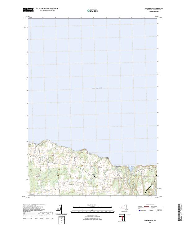
2023 Map of Salmon Creek
USGS Topo · Published 2023About this map
Lake Ontario defines the northern reaches of this Wayne County landscape, where the shoreline is punctuated by geographic landmarks like Bootleggers Point and Sprong Bluff. Moving inland, the terrain is shaped by the drainage of Salmon Creek and Sill Creek, which flow toward Maxwell Bay near the village of Sodus Point. The map captures a largely agricultural and rural residential character, evidenced by the extensive road network including N Centenary Rd and Maple Ave.
Find a feature on this map
37 named features on this map. Tap any name to fly to it.
Don’t see what you’re looking for? This feature index may not catch every label — zoom into the map to look around manually.
Map Details
Editions of this 2023 Salmon Creek Map
This is the sole edition of this map. No revisions or reprints were ever made.
Other maps of this area

1899 · Palmyra
USGS Topo · 1:62,500

1902 · Sodus Bay
USGS Topo · 1:62,500

1902 · Pultneyville
USGS Topo · 1:62,500

1902 · Clyde
USGS Topo · 1:62,500

1902 · Palmyra
USGS Topo · 1:62,500

1942 · Pultneyville
USGS Topo · 1:31,680

1943 · Williamson
USGS Topo · 1:31,680

1943 · Sodus Point
USGS Topo · 1:31,680

1943 · Sodus
USGS Topo · 1:31,680
1943 · Rose
USGS Topo · 1:31,680