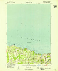
1952 Map of Salmon Creek
USGS Topo · Published 1953About this map
Lake Ontario dominates the northern half of this coastal survey, where the shoreline is defined by dramatic features like Sprong Bluff and Bootleggers Point. The inland landscape within Sodus is a network of rural routes such as Van Lare Rd and Middle Road, connecting family-named landmarks and small community centers. Genealogists will find significant value in the documentation of local burial grounds, including Centenary Cem, Swales Cem, and Bushnell Cem, which anchor the agricultural landscape.
Find a feature on this map
27 named features on this map. Tap any name to fly to it.
Don’t see what you’re looking for? This feature index may not catch every label — zoom into the map to look around manually.
Map Details
Editions of this 1952 Salmon Creek Map
This is the sole edition of this map. No revisions or reprints were ever made.
Other maps of this area

1899 · Palmyra
USGS Topo · 1:62,500

1902 · Sodus Bay
USGS Topo · 1:62,500

1902 · Pultneyville
USGS Topo · 1:62,500

1902 · Clyde
USGS Topo · 1:62,500

1902 · Palmyra
USGS Topo · 1:62,500

1942 · Pultneyville
USGS Topo · 1:31,680

1943 · Williamson
USGS Topo · 1:31,680

1943 · Sodus Point
USGS Topo · 1:31,680

1943 · Sodus
USGS Topo · 1:31,680
1943 · Rose
USGS Topo · 1:31,680