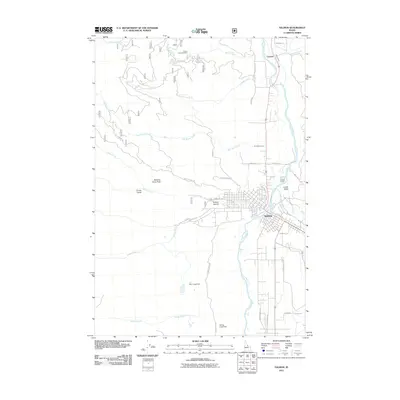
2011 Map of Salmon
USGS Topo · Published 2011About this map
The confluence of the Salmon River and the Lemhi River serves as the geographic and economic heart of this Idaho landscape. The city of Salmon is the primary hub, showing a grid of streets that extend toward the Lemhi Valley and the adjacent foothills. North of town, the community of Carmen sits near the mouth of Carmen Creek, where the Big Flat Ditch indicates a reliance on managed water for local agriculture and settlement.
Find a feature on this map
38 named features on this map. Tap any name to fly to it.
Don’t see what you’re looking for? This feature index may not catch every label — zoom into the map to look around manually.
Map Details
Editions of this 2011 Salmon Map
This is the sole edition of this map. No revisions or reprints were ever made.
Other maps of this area

1950 · Salmon
USGS Topo · 1:62,500

1950 · Leesburg
USGS Topo · 1:62,500

1951 · Leesburg
USGS Topo · 1:62,500

1951 · Salmon
USGS Topo · 1:62,500

1955 · Dillon
USGS Topo · 1:250,000

1956 · Elk City
USGS Topo · 1:250,000

1957 · Dillon
USGS Topo · 1:250,000

1958 · Dillon
USGS Topo · 1:250,000

1960 · Elk City
USGS Topo · 1:250,000

1960 · Ulysses Mtn
USGS Topo · 1:62,500