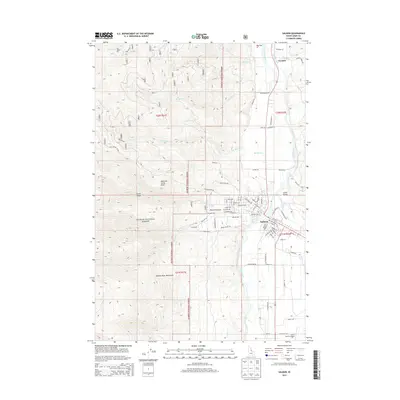
2013 Map of Salmon
USGS Topo · Published 2013About this map
The town of Salmon sits at the confluence of the Salmon River and Lemhi River, serving as a central hub in the deep Lemhi Valley. This 2013 topographic survey illustrates the transition from the structured street grid of the town center to the expansive reaches of the Salmon National Forest. Higher elevations to the west are dominated by the Salmon River Mountains, where prominent landmarks such as Morning Glory Peak and Turner Gulch define the high country. Agricultural and irrigation infrastructure is evident through features like the Big First Ditch near the northern settlement of Carmen. The map also details the local road network connecting outlying areas like Big Flat and Pollard Canyon, providing a clear view of how the valley's topography has dictated the patterns of settlement and transport along the river corridors.
Find a feature on this map
79 named features on this map. Tap any name to fly to it.
Don’t see what you’re looking for? This feature index may not catch every label — zoom into the map to look around manually.
Map Details
Editions of this 2013 Salmon Map
This is the sole edition of this map. No revisions or reprints were ever made.
Other maps of this area

1950 · Salmon
USGS Topo · 1:62,500

1950 · Leesburg
USGS Topo · 1:62,500

1951 · Leesburg
USGS Topo · 1:62,500

1951 · Salmon
USGS Topo · 1:62,500

1955 · Dillon
USGS Topo · 1:250,000

1956 · Elk City
USGS Topo · 1:250,000

1957 · Dillon
USGS Topo · 1:250,000

1958 · Dillon
USGS Topo · 1:250,000

1960 · Elk City
USGS Topo · 1:250,000

1960 · Ulysses Mtn
USGS Topo · 1:62,500