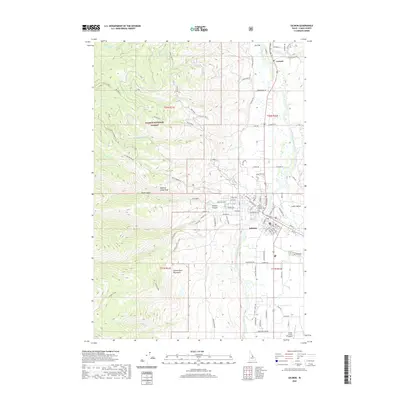
2020 Map of Salmon
USGS Topo · Published 2020About this map
Salmon sits at the confluence of several mountain drainages where the Salmon River flows northward through the Lemhi Valley. This modern topographical survey illustrates the town's position as a regional hub, anchored by the Lemhi County Courthouse and serving as a gateway to the expansive Salmon National Forest. The map detail captures the residential grid extending toward the City Cem, while the Lemhi County Airport provides critical access to this high-altitude landscape.
Find a feature on this map
99 named features on this map. Tap any name to fly to it.
Don’t see what you’re looking for? This feature index may not catch every label — zoom into the map to look around manually.
Map Details
Editions of this 2020 Salmon Map
This is the sole edition of this map. No revisions or reprints were ever made.
Other maps of this area

1950 · Salmon
USGS Topo · 1:62,500

1950 · Leesburg
USGS Topo · 1:62,500

1951 · Leesburg
USGS Topo · 1:62,500

1951 · Salmon
USGS Topo · 1:62,500

1955 · Dillon
USGS Topo · 1:250,000

1956 · Elk City
USGS Topo · 1:250,000

1957 · Dillon
USGS Topo · 1:250,000

1958 · Dillon
USGS Topo · 1:250,000

1960 · Elk City
USGS Topo · 1:250,000

1960 · Ulysses Mtn
USGS Topo · 1:62,500