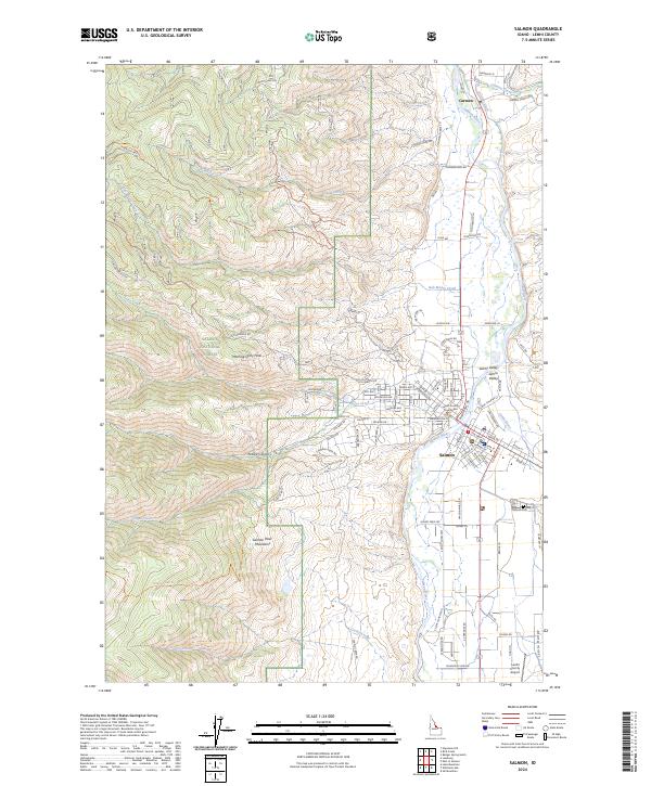
2024 Map of Salmon
USGS Topo · Published 2024About this map
Salmon serves as the focal point of this Lemhi County survey, situated at the confluence of the Salmon River and the Lemhi River. The town's grid is dense with local administrative and civic markers, including the Lemhi County Courthouse and the nearby Salmon Cem. This location reflects its role as a regional hub, connected to the broader landscape by the Lemhi County Airport to the south. Surrounding the valley, the terrain rises sharply into the Salmon National Forest, characterized by landmarks such as Morning Glory Peak and the branching drainage of Pollard Canyon. In the northern reach, the small settlement of Carmen sits near Carmen Creek, while various irrigation features like the Big Flat Ditch trace the valley floor, illustrating the vital relationship between the river system and local land use. To the west, the Salmon River Mountains dominate the horizon, while the Lemhi Range borders the eastern edge of the valley.
Find a feature on this map
120 named features on this map. Tap any name to fly to it.
Don’t see what you’re looking for? This feature index may not catch every label — zoom into the map to look around manually.
Map Details
Editions of this 2024 Salmon Map
This is the sole edition of this map. No revisions or reprints were ever made.
Other maps of this area

1950 · Salmon
USGS Topo · 1:62,500

1950 · Leesburg
USGS Topo · 1:62,500

1951 · Leesburg
USGS Topo · 1:62,500

1951 · Salmon
USGS Topo · 1:62,500

1955 · Dillon
USGS Topo · 1:250,000

1956 · Elk City
USGS Topo · 1:250,000

1957 · Dillon
USGS Topo · 1:250,000

1958 · Dillon
USGS Topo · 1:250,000

1960 · Elk City
USGS Topo · 1:250,000

1960 · Ulysses Mtn
USGS Topo · 1:62,500