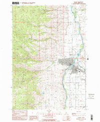
1989 Map of Salmon
USGS Topo · Published 1989About this map
The Salmon River and Lemhi River converge in the late 1980s, anchoring a landscape where mountain mining meets river-valley commerce. This survey details the town of Salmon, showing its central core with the Post Office, Courthouse, and High School, alongside infrastructure like the Salmon Airport and Heliport. North of town, the Fairground and a Drive-in Theater highlight local leisure, while the rugged slopes of the Salmon National Forest to the west are dotted with extractive history, including the Queen of the Hills Mine and numerous unnamed prospects and adits. From the drainage of Jesse Creek to the summit of Morning Glory Peak, the map captures a period of transition for the county seat as it balanced its frontier mining identity with modern municipal expansion.
Find a feature on this map
41 named features on this map. Tap any name to fly to it.
Don’t see what you’re looking for? This feature index may not catch every label — zoom into the map to look around manually.
Map Details
Editions of this 1989 Salmon Map
This is the sole edition of this map. No revisions or reprints were ever made.
Other maps of this area

1950 · Salmon
USGS Topo · 1:62,500

1950 · Leesburg
USGS Topo · 1:62,500

1951 · Leesburg
USGS Topo · 1:62,500

1951 · Salmon
USGS Topo · 1:62,500

1955 · Dillon
USGS Topo · 1:250,000

1956 · Elk City
USGS Topo · 1:250,000

1957 · Dillon
USGS Topo · 1:250,000

1958 · Dillon
USGS Topo · 1:250,000

1960 · Elk City
USGS Topo · 1:250,000

1960 · Ulysses Mtn
USGS Topo · 1:62,500