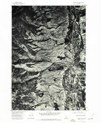
1974 Map of Salmon NW
USGS Topo · Published 1977About this map
Salmon sits at a critical junction of the Salmon River and the surrounding high desert terrain in this 1974 orthophotoquad. Produced in cooperation with the U.S. Forest Service, this map utilizes aerial photography to reveal the town's compact grid and its immediate relationship to the river's winding path and the encroaching canyon lands. To the west, the deep indentation of Pollard Canyon cuts into the rising mountainside, illustrating the geographic constraints that have shaped the town's development since its early days as a mining and ranching hub. The imagery provides an unfiltered view of the agricultural fields and riparian zones lining the riverbanks, offering a clear record of land use and vegetation patterns during the mid-1970s.
Find a feature on this map
3 named features on this map. Tap any name to fly to it.
Don’t see what you’re looking for? This feature index may not catch every label — zoom into the map to look around manually.
Map Details
Editions of this 1974 Salmon NW Map
This is the sole edition of this map. No revisions or reprints were ever made.
Other maps of this area

1950 · Salmon
USGS Topo · 1:62,500

1950 · Leesburg
USGS Topo · 1:62,500

1951 · Leesburg
USGS Topo · 1:62,500

1951 · Salmon
USGS Topo · 1:62,500

1955 · Dillon
USGS Topo · 1:250,000

1956 · Elk City
USGS Topo · 1:250,000

1957 · Dillon
USGS Topo · 1:250,000

1958 · Dillon
USGS Topo · 1:250,000

1960 · Elk City
USGS Topo · 1:250,000

1960 · Ulysses Mtn
USGS Topo · 1:62,500