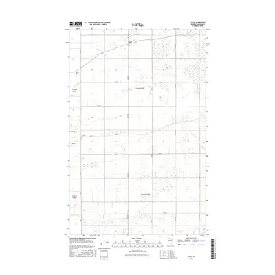
2016 Map of Salol
USGS Topo · Published 2016About this map
Salol anchors the northern portion of this Roseau County landscape, appearing as a quiet crossroads community surrounded by the expansive agricultural and wetland drainage networks characteristic of the region. The map reveals a highly structured grid of section lines and county roads, reflecting the systematic land survey of the Minnesota prairie-border country. Water management is a primary feature of the terrain, visible through the engineered course of County Ditch Number Seven and the natural meanders of Bear Cr and Cow Cr. These waterways are essential components of the local hydrology, supporting the farming operations that define the area's economy. Genealogists and local historians will find significant value in the location of Spruce Cem and Fairview Cem, which serve as vital landmarks for tracing the early families who settled this northern frontier. The map provides a clear record of rural infrastructure, from the primary corridor of 320th ST to the numerous local avenues and township roads that connect isolated farmsteads.
Find a feature on this map
29 named features on this map. Tap any name to fly to it.
Don’t see what you’re looking for? This feature index may not catch every label — zoom into the map to look around manually.
Map Details
Editions of this 2016 Salol Map
This is the sole edition of this map. No revisions or reprints were ever made.
Other maps of this area

1918 · Goos
USGS Topo · 1:62,500

1918 · Pencer
USGS Topo · 1:62,500

1918 · Warroad
USGS Topo · 1:62,500

1943 · Goos
USGS Topo · 1:62,500

1943 · Warroad
USGS Topo · 1:62,500

1954 · Roseau
USGS Topo · 1:250,000

1957 · Roseau
USGS Topo · 1:250,000

1958 · Roseau
USGS Topo · 1:250,000

1966 · Salol NW
USGS Topo · 1:24,000

1966 · Malung
USGS Topo · 1:24,000