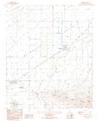
1990 Map of Salome
USGS Topo · Published 1990About this map
Mc Mullen Valley serves as the backdrop for this arid landscape, where the neighboring desert communities of Salome and Wenden are linked by the rail line and the sprawling course of Centennial Wash. In the early 1990s, this area reflects a mix of small-town infrastructure and rugged resource extraction. The Bicentennial Union High Sch and several landing strips anchor the settlements, while the slopes of the Harquahala Mountains and S Mountain are dotted with mining activity. Prospectors and historians can identify numerous prospects and established sites like the Hercules Mine and Bunker Hill Mine. The map reveals the layout of the Centennial Park and the nearby Cem, providing a detailed record of the human footprint within the basin. Local roads such as Alamo Road and Harrisburg Valley Road navigate the terrain, connecting the valley floor to the prominent Twin Peaks.
Find a feature on this map
18 named features on this map. Tap any name to fly to it.
Don’t see what you’re looking for? This feature index may not catch every label — zoom into the map to look around manually.
Map Details
Editions of this 1990 Salome Map
This is the sole edition of this map. No revisions or reprints were ever made.
Other maps of this area

1942 · Vicksburg
USGS Topo · 1:250,000

1954 · Phoenix
USGS Topo · 1:250,000

1957 · Phoenix
USGS Topo · 1:250,000

1958 · Phoenix
USGS Topo · 1:250,000

1960 · Phoenix
USGS Topo · 1:250,000

1961 · Salome
USGS Topo · 1:62,500

1961 · Hope
USGS Topo · 1:62,500

1961 · Lone Mountain
USGS Topo · 1:62,500

1961 · Gladden
USGS Topo · 1:62,500

1969 · Phoenix
USGS Topo · 1:250,000