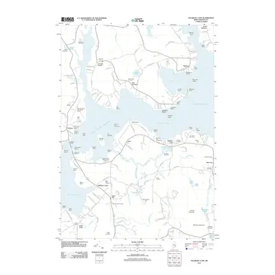
2011 Map of Salsbury Cove
USGS Topo · Published 2011About this map
The Mount Desert Narrows and Eastern Bay dominate this coastal landscape, separating the mainland settlements of East Lamoine and Marlboro from the northern reach of Mount Desert Island. In the early 21st century, this area serves as a primary gateway to the island, with the Hancock County - Bar Harbor Airport and the Trenton bridge providing vital infrastructure. The map reveals a dense network of family-named cemeteries and landmarks that speak to the region's long-established communities, including Salsbury Cemetery and Forest Hill Cemetery.
Find a feature on this map
156 named features on this map. Tap any name to fly to it.
Don’t see what you’re looking for? This feature index may not catch every label — zoom into the map to look around manually.
Map Details
Editions of this 2011 Salsbury Cove Map
This is the sole edition of this map. No revisions or reprints were ever made.
Other maps of this area

1904 · Mount Desert
USGS Topo · 1:62,500

1904 · Bar Harbor
USGS Topo · 1:62,500

1911 · Ellsworth
USGS Topo · 1:62,500

1930 · Tunk Lake
USGS Topo · 1:48,000

1932 · Tunk Lake
USGS Topo · 1:62,500

1940 · Ellsworth
USGS Topo · 1:62,500

1942 · Bar Harbor
USGS Topo · 1:62,500

1942 · Ellsworth
USGS Topo · 1:62,500

1942 · Mount Desert
USGS Topo · 1:62,500

1942 · Tunk Lake
USGS Topo · 1:62,500