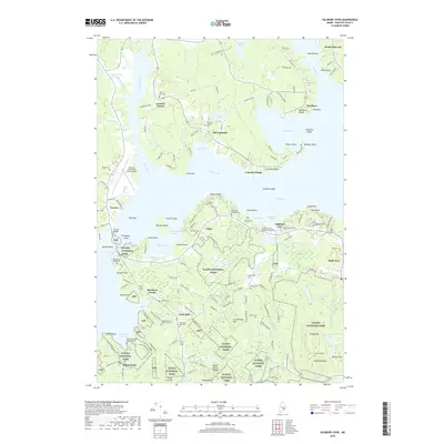
2018 Map of Salsbury Cove
USGS Topo · Published 2018About this map
Acadia National Park dominates the southern landscape of this 2018 survey, where the rugged coast of Mount Desert Island meets the waters of the Jordan River and Eastern Bay. The map provides a detailed look at the island's northern reaches and the mainland communities of Lamoine Corner and East Lamoine. Family history and local heritage are well-preserved through numerous burial sites, including the Emery Family Burial Ground near Salsbury Cove and the Higgins Marcyes Burial Ground further inland. The transportation network is anchored by the Hancock County-Bar Harbor Airport and the Trenton Bridge, which serves as the primary link between the mainland and the island. Extensive wetlands like The Heath and Jones Marsh characterize the low-lying drainage patterns between the coastal heights of McFarland Mtn and Youngs Mtn.
Find a feature on this map
170 named features on this map. Tap any name to fly to it.
Don’t see what you’re looking for? This feature index may not catch every label — zoom into the map to look around manually.
Map Details
Editions of this 2018 Salsbury Cove Map
This is the sole edition of this map. No revisions or reprints were ever made.
Other maps of this area

1904 · Mount Desert
USGS Topo · 1:62,500

1904 · Bar Harbor
USGS Topo · 1:62,500

1911 · Ellsworth
USGS Topo · 1:62,500

1930 · Tunk Lake
USGS Topo · 1:48,000

1932 · Tunk Lake
USGS Topo · 1:62,500

1940 · Ellsworth
USGS Topo · 1:62,500

1942 · Bar Harbor
USGS Topo · 1:62,500

1942 · Ellsworth
USGS Topo · 1:62,500

1942 · Mount Desert
USGS Topo · 1:62,500

1942 · Tunk Lake
USGS Topo · 1:62,500