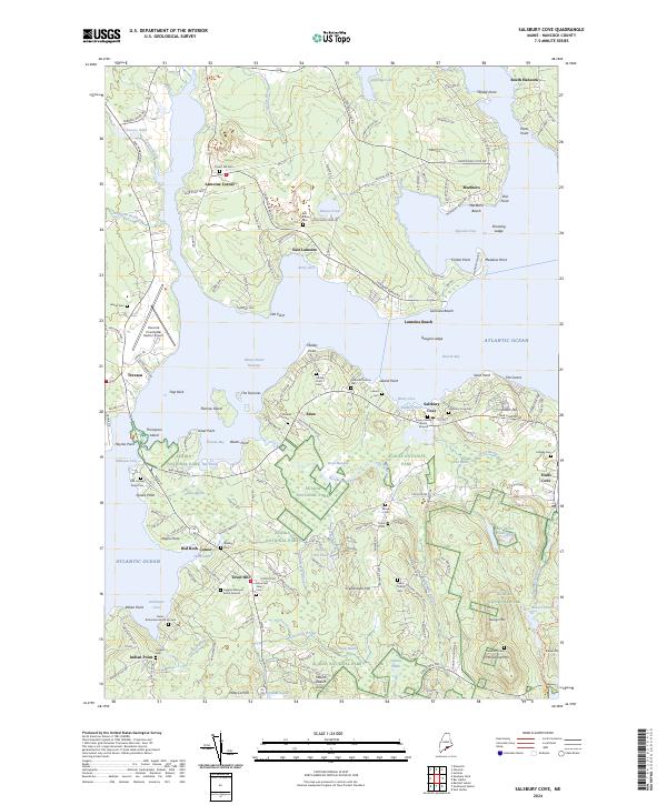
2024 Map of Salsbury Cove
USGS Topo · Published 2024About this map
Mount Desert Island and the mainland at Lamoine Corner are linked by the coastal geography of Eastern Bay and the Mount Desert Narrows. This modern survey illustrates the proximity of Acadia National Park to historic village centers such as Salsbury Cove and Town Hill. The landscape is heavily marked by family-named burial sites and historic plots, including the Emery Family Burial Ground, Higgins Marcyes Burial-Ground, and the isolated Newman Grave near McFarland Mtn. Drainage patterns defined by Northeast Creek and Frenchman Hill Brook feed into the complex shoreline of Thomas Bay and Clark Cove. The map also captures the modern infrastructure of the Hancock County/Bar Harbor Airport positioned just west of the Jordan River.
Find a feature on this map
180 named features on this map. Tap any name to fly to it.
Don’t see what you’re looking for? This feature index may not catch every label — zoom into the map to look around manually.
Map Details
Editions of this 2024 Salsbury Cove Map
This is the sole edition of this map. No revisions or reprints were ever made.
Other maps of this area

1904 · Mount Desert
USGS Topo · 1:62,500

1904 · Bar Harbor
USGS Topo · 1:62,500

1911 · Ellsworth
USGS Topo · 1:62,500

1930 · Tunk Lake
USGS Topo · 1:48,000

1932 · Tunk Lake
USGS Topo · 1:62,500

1940 · Ellsworth
USGS Topo · 1:62,500

1942 · Bar Harbor
USGS Topo · 1:62,500

1942 · Ellsworth
USGS Topo · 1:62,500

1942 · Mount Desert
USGS Topo · 1:62,500

1942 · Tunk Lake
USGS Topo · 1:62,500