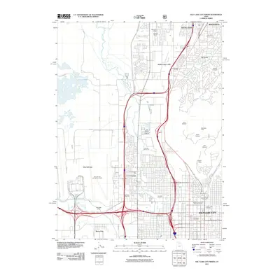
2011 Map of Salt Lake City North
USGS Topo · Published 2011About this map
Ensign Peak and Meridian Peak anchor the high ground overlooking the northern expansion of the Salt Lake Valley in this detailed 2011 record. The map documents the dense urban grid of Salt Lake City as it transitions into the residential and industrial corridors of North Salt Lake, Woods Cross, and Bountiful. Notable for genealogists are the well-preserved sacred grounds, including the Brigham Young Family Memorial Cemetery and the Kimball-Whitney Cemetery located near the city center.
Find a feature on this map
57 named features on this map. Tap any name to fly to it.
Don’t see what you’re looking for? This feature index may not catch every label — zoom into the map to look around manually.
Map Details
Editions of this 2011 Salt Lake City North Map
This is the sole edition of this map. No revisions or reprints were ever made.
Other maps of this area

1885 · Salt Lake
USGS Topo · 1:250,000

1885 · Tooele Valley
USGS Topo · 1:250,000

1925 · Ft. Douglas
USGS Topo · 1:125,000

1928 · Ft. Douglas
USGS Topo · 1:125,000

1950 · Fort Douglas
USGS Topo · 1:24,000

1951 · Fort Douglas
USGS Topo · 1:24,000

1951 · Saltair
USGS Topo · 1:24,000

1951 · Salt Lake City South
USGS Topo · 1:24,000

1951 · Salt Lake City North
USGS Topo · 1:24,000

1952 · Saltair NE
USGS Topo · 1:24,000