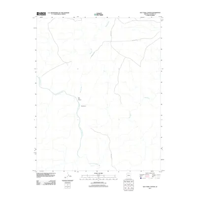
2011 Map of Salt Trail Canyon
USGS Topo · Published 2011About this map
The Little Colorado River defines the dramatic desert landscape of this portion of Coconino County, carving a path through the arid plateau. The topography is dominated by steep-walled drainages, most notably at Salt Trail Canyon and the confluence with Big Canyon. This area is characterized by ephemeral water systems that only flow during significant rain events, such as Bekihatso Wash and Sheep Wash, which branch out across the high desert floor.
Find a feature on this map
8 named features on this map. Tap any name to fly to it.
Don’t see what you’re looking for? This feature index may not catch every label — zoom into the map to look around manually.
Map Details
Editions of this 2011 Salt Trail Canyon Map
This is the sole edition of this map. No revisions or reprints were ever made.
Other maps of this area

1886 · Echo Cliffs
USGS Topo · 1:250,000

1891 · Echo Cliffs
USGS Topo · 1:250,000

1907 · Vishnu
USGS Topo · 1:48,000

1954 · Shinumo Altar SE
USGS Topo · 1:24,000

1954 · Nankoweap
USGS Topo · 1:62,500

1954 · Shinumo Altar
USGS Topo · 1:62,500

1955 · Blue Spring NE
USGS Topo · 1:24,000
1955 · Blue Spring SE
USGS Topo · 1:24,000

1955 · Blue Spring
USGS Topo · 1:62,500

1956 · Marble Canyon
USGS Topo · 1:250,000