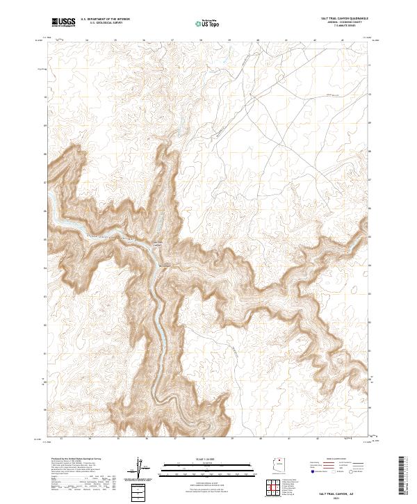
2021 Map of Salt Trail Canyon
USGS Topo · Published 2021About this map
The Little Colorado River Gorge dominates this northern Arizona landscape, where the Little Colorado River carves deeply through the desert plateau. The terrain is defined by dramatic geological breaks, most notably Salt Trail Canyon and Big Canyon, which reveal the complex erosion patterns typical of Coconino County. These canyons act as natural conduits through a high-altitude wilderness, with the dry beds of Bekihatso Wash and Sheep Wash providing further drainage across the arid surface. While the interior of the gorge remains largely inaccessible by road, the surrounding plateaus are navigated by a network of tribal routes including Indian Rte 6120 and Indian Rte 6130. This mapping effort by the U.S. Geological Survey documents the intersection of modern transportation routes and prehistoric geological features within the Navajo Nation.
Find a feature on this map
15 named features on this map. Tap any name to fly to it.
Don’t see what you’re looking for? This feature index may not catch every label — zoom into the map to look around manually.
Map Details
Editions of this 2021 Salt Trail Canyon Map
This is the sole edition of this map. No revisions or reprints were ever made.
Other maps of this area

1886 · Echo Cliffs
USGS Topo · 1:250,000

1891 · Echo Cliffs
USGS Topo · 1:250,000

1907 · Vishnu
USGS Topo · 1:48,000

1954 · Shinumo Altar SE
USGS Topo · 1:24,000

1954 · Nankoweap
USGS Topo · 1:62,500

1954 · Shinumo Altar
USGS Topo · 1:62,500

1955 · Blue Spring NE
USGS Topo · 1:24,000
1955 · Blue Spring SE
USGS Topo · 1:24,000

1955 · Blue Spring
USGS Topo · 1:62,500

1956 · Marble Canyon
USGS Topo · 1:250,000