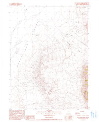
1990 Map of Salt Water Spring
USGS Topo · Published 1990About this map
The eastern margins of the Black Rock Desert meet the rising slopes of the Jackson Mtns in this 1990 provisional study of Humboldt County. The landscape is defined by its scarce water sources, where isolated points like Salt Water Spring, Hot Spring, and Butte Spring served as vital landmarks in an arid expanse. Evidence of human activity in this remote basin is visible through the Bill DeLong Well and the seasonal presence at Winter Camp. The topography transitions sharply from the level Jackson Creek Slough to the steep, drainage-cut eastern highlands. Several prominent incisions, including Rattlesnake Canyon and Black Rock Canyon, drain the mountain front toward the desert floor. This map captures a specific moment in the late 20th century before modern digital surveying, based on earlier aerial photography and field checks that document the persistence of traditional named locations in the Great Basin.
Find a feature on this map
13 named features on this map. Tap any name to fly to it.
Don’t see what you’re looking for? This feature index may not catch every label — zoom into the map to look around manually.
Map Details
Editions of this 1990 Salt Water Spring Map
This is the sole edition of this map. No revisions or reprints were ever made.
Other maps of this area

1886 · Disaster
USGS Topo · 1:250,000

1893 · Disaster
USGS Topo · 1:250,000

1931 · Lovelock
USGS Topo · 1:250,000

1935 · Lovelock
USGS Topo · 1:250,000

1954 · Vya
USGS Topo · 1:250,000

1955 · Lovelock
USGS Topo · 1:250,000

1958 · Vya
USGS Topo · 1:250,000

1959 · Lovelock
USGS Topo · 1:250,000

1962 · Vya
USGS Topo · 1:250,000

1966 · King Lear Peak
USGS Topo · 1:62,500