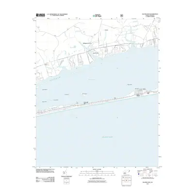
2011 Map of Salter Path
USGS Topo · Published 2011About this map
Bogue Sound separates the mainland Carteret County coastline from the narrow barrier island communities of the Crystal Coast in this 2011 survey. The coastal landscape is defined by the thin strip of land containing Emerald Isle, Indian Beach, and the historic village of Salter Path. These settlements are situated between the sound and the Atlantic Ocean, showing a dense pattern of residential streets like Ocean Dr and Bogue Sound Dr.
Find a feature on this map
79 named features on this map. Tap any name to fly to it.
Don’t see what you’re looking for? This feature index may not catch every label — zoom into the map to look around manually.
Map Details
Editions of this 2011 Salter Path Map
This is the sole edition of this map. No revisions or reprints were ever made.
Other maps of this area

1942 · Maysville
USGS Topo · 1:62,500

1942 · Swansboro
USGS Topo · 1:62,500

1948 · Maysville
USGS Topo · 1:62,500

1948 · Swansboro
USGS Topo · 1:62,500

1949 · Newport
USGS Topo · 1:24,000

1949 · Salter Path
USGS Topo · 1:24,000

1949 · Mansfield
USGS Topo · 1:24,000

1949 · Masontown
USGS Topo · 1:24,000

1951 · Salter Path
USGS Topo · 1:24,000

1951 · Newport
USGS Topo · 1:24,000