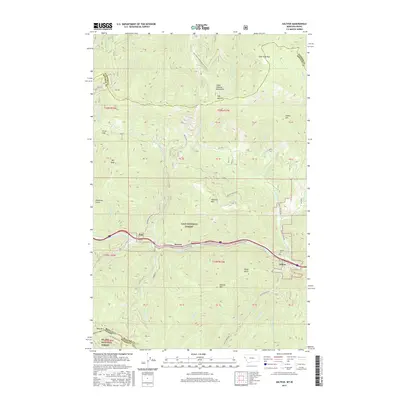
2017 Map of Saltese
USGS Topo · Published 2017About this map
The Saint Regis River valley serves as the primary corridor for transportation and settlement in this corner of the Coeur d'Alene Mountains. Small communities like Saltese, Bryson, and Taft are clustered along the river, positioned between the high peaks of the Lolo National Forest and the St Joe National Forest. This 2017 survey reflects the enduring influence of the NP Railway and regional road networks that traverse the steep mountain passes, including Taft Summit and East Fork Pass. The map documents the high-elevation landscape where the Montana Idaho state line meets county boundaries, punctuated by prominent landmarks such as Saltese Mtn, Hemlock Mtn, and Taft Peak. Local history and genealogy interest is anchored by the Saltese Cem, located near the junction of Packer Cr and the river valley.
Find a feature on this map
45 named features on this map. Tap any name to fly to it.
Don’t see what you’re looking for? This feature index may not catch every label — zoom into the map to look around manually.
Map Details
Editions of this 2017 Saltese Map
This is the sole edition of this map. No revisions or reprints were ever made.
Other maps of this area

1914 · Avery
USGS Topo · 1:125,000

1917 · Avery
USGS Topo · 1:125,000

1918 · St Regis
USGS Topo · 1:125,000

1919 · St. Regis
USGS Topo · 1:125,000

1932 · Trout Creek
USGS Topo · 1:125,000

1935 · Trout Creek
USGS Topo · 1:125,000

1936 · Trout Creek
USGS Topo · 1:125,000

1937 · Thompson Falls
USGS Topo · 1:125,000

1937 · Thompson Falls
USGS Topo · 1:62,500

1956 · Cooper Gulch
USGS Topo · 1:62,500