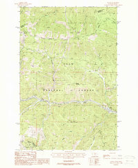
1988 Map of Saltese
USGS Topo · Published 1988About this map
Saltese sits at the heart of this high-country landscape where the St Regis River carves through the Bitterroot Mountains along the border of Lolo National Forest and St Joe National Forest. The map documents a critical transportation corridor, marked by the presence of Old Railroad Grades and an Old RR Grade that parallel the river and modern transmission lines. These industrial artifacts contrast with the rugged peaks of Taft Peak, Hemlock Mountain, and Saltese Mountain.
Find a feature on this map
44 named features on this map. Tap any name to fly to it.
Don’t see what you’re looking for? This feature index may not catch every label — zoom into the map to look around manually.
Map Details
Editions of this 1988 Saltese Map
This is the sole edition of this map. No revisions or reprints were ever made.
Other maps of this area

1914 · Avery
USGS Topo · 1:125,000

1917 · Avery
USGS Topo · 1:125,000

1918 · St Regis
USGS Topo · 1:125,000

1919 · St. Regis
USGS Topo · 1:125,000

1932 · Trout Creek
USGS Topo · 1:125,000

1935 · Trout Creek
USGS Topo · 1:125,000

1936 · Trout Creek
USGS Topo · 1:125,000

1937 · Thompson Falls
USGS Topo · 1:125,000

1937 · Thompson Falls
USGS Topo · 1:62,500

1956 · Cooper Gulch
USGS Topo · 1:62,500