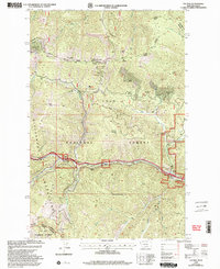
1999 Map of Saltese
USGS Topo · Published 2003About this map
The Regis River corridor serves as the primary artery for transport and settlement through this mountainous stretch of the Lolo National Forest and St Joe National Forest. This 1999 revision captures the high country where the Coeur d'Alene Mountains and Bitterroot Mountains meet along the Montana-Idaho border. The map documents the legacy of early twentieth-century mining and railroading, most notably at Taft (Site), a location once known for its importance during the construction of the Milwaukee Road.
Find a feature on this map
37 named features on this map. Tap any name to fly to it.
Don’t see what you’re looking for? This feature index may not catch every label — zoom into the map to look around manually.
Map Details
Editions of this 1999 Saltese Map
This is the sole edition of this map. No revisions or reprints were ever made.
Other maps of this area

1914 · Avery
USGS Topo · 1:125,000

1917 · Avery
USGS Topo · 1:125,000

1918 · St Regis
USGS Topo · 1:125,000

1919 · St. Regis
USGS Topo · 1:125,000

1932 · Trout Creek
USGS Topo · 1:125,000

1935 · Trout Creek
USGS Topo · 1:125,000

1936 · Trout Creek
USGS Topo · 1:125,000

1937 · Thompson Falls
USGS Topo · 1:125,000

1937 · Thompson Falls
USGS Topo · 1:62,500

1956 · Cooper Gulch
USGS Topo · 1:62,500