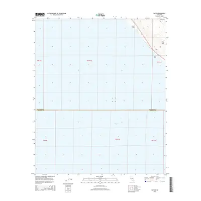
2015 Map of Salton
USGS Topo · Published 2015About this map
The eastern shoreline of the Salton Sea dominates this 2015 survey, where the water's edge meets a narrow strip of development along the desert floor. The small community of Salton and the residential clusters at Salton Beach and Betz Beach are concentrated between the high-water line and the rising inland topography. A distinct transition from the aquatic basin to the arid landscape is visible where the Desert Air Sky Ranch sits near the base of the surrounding hills. This survey illustrates the precise boundary line shared by Riverside and Imperial Counties, which cuts directly through the northern portion of the sea. Local infrastructure is minimal, defined by a few named thoroughfares like Sea Breeze Dr and Line Rd that provide access to this isolated lakeside stretch.
Find a feature on this map
14 named features on this map. Tap any name to fly to it.
Don’t see what you’re looking for? This feature index may not catch every label — zoom into the map to look around manually.
Map Details
Editions of this 2015 Salton Map
This is the sole edition of this map. No revisions or reprints were ever made.
Other maps of this area

1904 · Indio
USGS Topo · 1:125,000

1931 · Vallecito
USGS Topo · 1:125,000

1940 · Cottonwood Spring
USGS Topo · 1:62,500

1940 · Durmid
USGS Topo · 1:62,500

1941 · Coachella
USGS Topo · 1:62,500

1942 · Agua Dulce
USGS Topo · 1:62,500

1943 · Vallecito
USGS Topo · 1:125,000

1943 · Coachella
USGS Topo · 1:62,500

1944 · Agua Dulce
USGS Topo · 1:62,500

1944 · Cottonwood Spring
USGS Topo · 1:62,500