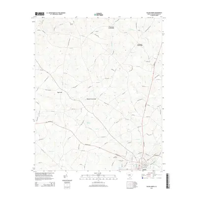
2014 Map of Saluda North
USGS Topo · Published 2014About this map
Saluda anchors the southern edge of this landscape, where the Little Saluda River and Burnets Cr converge near Travis Park Cem. This 2014 survey reveals a transition from the town's residential grid to the rural crossroads communities that define the upland interior of Saluda County. Points like Chapmans Crossroads, Colemans Crossroads, and Bleases Crossroads mark historic intersections of a dense local road network, including family-named routes such as Sam Etheredge Rd and RC Berry Rd. The terrain is deeply etched by a network of waterways like Big Cr and Dry Cr, which support agricultural ponds such as Wheelers Pond and Felkels Pond. Notable landmarks, including the Saluda Lookout Tower and Chestnut Hill Cem in the north, provide essential points of reference for local historians and genealogists studying the rural settlement patterns of central South Carolina.
Find a feature on this map
106 named features on this map. Tap any name to fly to it.
Don’t see what you’re looking for? This feature index may not catch every label — zoom into the map to look around manually.
Map Details
Editions of this 2014 Saluda North Map
This is the sole edition of this map. No revisions or reprints were ever made.
Other maps of this area

1941 · Spartanburg
USGS Topo · 1:250,000

1953 · Spartanburg
USGS Topo · 1:250,000

1954 · Augusta
USGS Topo · 1:250,000

1957 · Augusta
USGS Topo · 1:250,000

1958 · Augusta
USGS Topo · 1:250,000

1960 · Spartanburg
USGS Topo · 1:250,000

1961 · Augusta
USGS Topo · 1:250,000

1962 · Augusta
USGS Topo · 1:250,000

1963 · Spartanburg
USGS Topo · 1:250,000

1964 · Spartanburg
USGS Topo · 1:250,000