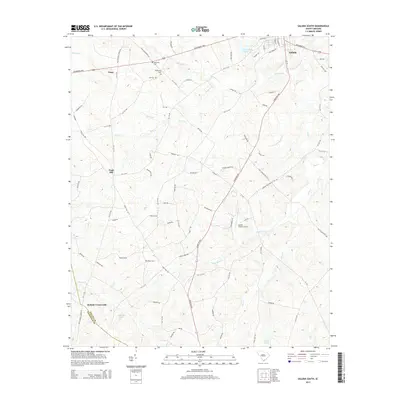
2014 Map of Saluda South
USGS Topo · Published 2014About this map
Saluda sits at the northern edge of this Piedmont landscape, serving as a hub for the surrounding agricultural and rural communities. The terrain is defined by a dense network of waterways, most notably the Little Saluda River and Mine Cr, which carve through the undulating topography towards the New Saluda Reservoir. Scattered settlements and crossroads like Limp, Fruit Hill, and Mathais Crossroads reflect the historical settlement patterns of the region, where local commerce was anchored by proximity to fertile land and creek branches. Family and local history is preserved in sites such as Gassaway Cem and Wright Cem, which sit alongside established routes like the McCormick Hwy and Johnston Hwy. The presence of the Saluda County Airport and the boundary between Saluda County and Edgefield County further define the administrative and modern character of the area.
Find a feature on this map
69 named features on this map. Tap any name to fly to it.
Don’t see what you’re looking for? This feature index may not catch every label — zoom into the map to look around manually.
Map Details
Editions of this 2014 Saluda South Map
This is the sole edition of this map. No revisions or reprints were ever made.
Other maps of this area

1941 · Spartanburg
USGS Topo · 1:250,000

1953 · Spartanburg
USGS Topo · 1:250,000

1954 · Augusta
USGS Topo · 1:250,000

1957 · Augusta
USGS Topo · 1:250,000

1958 · Augusta
USGS Topo · 1:250,000

1960 · Spartanburg
USGS Topo · 1:250,000

1961 · Augusta
USGS Topo · 1:250,000

1962 · Augusta
USGS Topo · 1:250,000

1963 · Spartanburg
USGS Topo · 1:250,000

1964 · Spartanburg
USGS Topo · 1:250,000