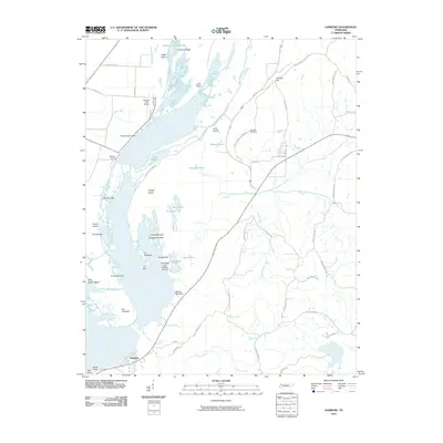
2010 Map of Samburg
USGS Topo · Published 2010About this map
Samburg anchors the southwestern edge of this survey, situated where the shore of Reelfoot Lake meets the surrounding drainage network of Indian Creek. This 2010 depiction reveals a landscape dominated by the complex aquatic ecology of the Reelfoot basin, featuring a dense network of named basins and channels including Yankapin Basin, Mud Basin, and Brewer Basin. The interaction between the open water and the low-lying terrain is evident in the numerous islands and bars, such as Grassy Island, Snaggy Bar, and Carey Towhead.
Find a feature on this map
60 named features on this map. Tap any name to fly to it.
Don’t see what you’re looking for? This feature index may not catch every label — zoom into the map to look around manually.
Map Details
Editions of this 2010 Samburg Map
This is the sole edition of this map. No revisions or reprints were ever made.
Other maps of this area

1925 · Reelfoot Lake
USGS Topo · 1:62,500

1939 · Reelfoot Lake
USGS Topo · 1:62,500

1939 · Hickman
USGS Topo · 1:62,500

1939 · Bayouville
USGS Topo · 1:62,500

1950 · Obion
USGS Topo · 1:24,000

1951 · Obion
USGS Topo · 1:24,000

1951 · Bondurant
USGS Topo · 1:24,000

1951 · Hickman
USGS Topo · 1:24,000

1951 · Hubbard Lake
USGS Topo · 1:24,000

1954 · Hickman
USGS Topo · 1:62,500