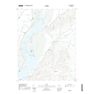
2019 Map of Samburg
USGS Topo · Published 2019About this map
The intricate shoreline of Reelfoot Lake dominates this modern topographic study, where the boundary between Lake Co and Obion Co follows the water's edge. The landscape is a complex network of arms, basins, and towheads, such as Eastridge Arm and Carey Towhead, reflecting the unique geography formed by historic seismic activity. To the south, the settlement of Samburg serves as a primary hub, while smaller locales like Walnut Log and Phillippy anchor the northern reaches near Hickory Ridge.
Find a feature on this map
94 named features on this map. Tap any name to fly to it.
Don’t see what you’re looking for? This feature index may not catch every label — zoom into the map to look around manually.
Map Details
Editions of this 2019 Samburg Map
This is the sole edition of this map. No revisions or reprints were ever made.
Other maps of this area

1925 · Reelfoot Lake
USGS Topo · 1:62,500

1939 · Reelfoot Lake
USGS Topo · 1:62,500

1939 · Hickman
USGS Topo · 1:62,500

1939 · Bayouville
USGS Topo · 1:62,500

1950 · Obion
USGS Topo · 1:24,000

1951 · Obion
USGS Topo · 1:24,000

1951 · Bondurant
USGS Topo · 1:24,000

1951 · Hickman
USGS Topo · 1:24,000

1951 · Hubbard Lake
USGS Topo · 1:24,000

1954 · Hickman
USGS Topo · 1:62,500