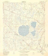
1949 Map of Sampson
USGS Topo · Published 1953About this map
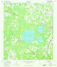
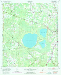
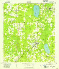
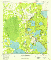
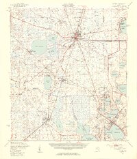
The lowlands of Bradford County are dominated by a cluster of prominent water bodies, most notably Lake Sampson, which serves as a central landmark for the surrounding cypress-dotted terrain. This 1940s landscape is defined by its strategic transportation corridors, where the Seaboard Air Line and the Southern railroads converge near the small settlement of Sampson and the Sampson City Sta. This junction highlights the area's historical role as a transit point for Florida's interior, connecting rural homesteads to larger regional markets. Away from the rails, the community is anchored by local institutions such as Rising Sch, Water-Oak Sch, and Pine Level Ch. To the east, an Emergency Airfield near Alligator Creek reflects mid-century infrastructure developments alongside smaller lakes like Lake Crosby and Lake Rowell.
Find a feature on this map
19 named features on this map. Tap any name to fly to it.
Don’t see what you’re looking for? This feature index may not catch every label — zoom into the map to look around manually.
Map Details
Editions of this 1949 Sampson Map
4 editions found
Other maps of this area

1918 · Lawtey
USGS Topo · 1:62,500

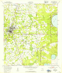
1941 · Starke
USGS Topo · 1:62,500

1948 · Starke
USGS Topo · 1:50,000

1949 · Sampson
USGS Topo · 1:24,000
1949 · Starke
USGS Topo · 1:24,000
1949 · Waldo
USGS Topo · 1:24,000
1949 · Keystone Heights
USGS Topo · 1:24,000
1949 · Starke
USGS Topo · 1:62,500

1954 · Gainesville
USGS Topo · 1:250,000

1954 · Valdosta
USGS Topo · 1:250,000