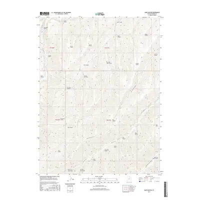
2017 Map of Sams Canyon
USGS Topo · Published 2017About this map
Avintaquin Cr flows through the northwestern corner of this high-elevation landscape in Duchesne County, where the terrain is defined by a dense network of drainages and named hollows. The area is characterized by seasonal water sources such as O'Driscoll Spring and Wildhorse Spring, which supported livestock and wildlife in this remote part of Utah. The naming conventions of the landscape—including Dipping Vat Hollow, Raspberry Hollow, and Rosie Hollow—hint at the agricultural and personal histories of the early residents. Navigation through this complex system of ridges and valleys is facilitated by several established routes, most notably Lake Canyon Rd and the Indian Canyon Right Fork Rd, which trace the natural contours of the deep canyons. Other significant geological features include Monument Gulch and the expansive Sams Canyon, reflecting the intricate erosion patterns typical of the Uinta Basin's fringe.
Find a feature on this map
38 named features on this map. Tap any name to fly to it.
Don’t see what you’re looking for? This feature index may not catch every label — zoom into the map to look around manually.
Map Details
Editions of this 2017 Sams Canyon Map
This is the sole edition of this map. No revisions or reprints were ever made.
Other maps of this area

1885 · Uinta
USGS Topo · 1:250,000

1886 · Price River
USGS Topo · 1:250,000

1896 · Price River
USGS Topo · 1:250,000

1954 · Salt Lake City
USGS Topo · 1:250,000

1956 · Price
USGS Topo · 1:250,000

1958 · Salt Lake City
USGS Topo · 1:250,000

1960 · Salt Lake City
USGS Topo · 1:250,000

1960 · Price
USGS Topo · 1:250,000

1962 · Price
USGS Topo · 1:250,000

1962 · Strawberry Pinnacles
USGS Topo · 1:24,000