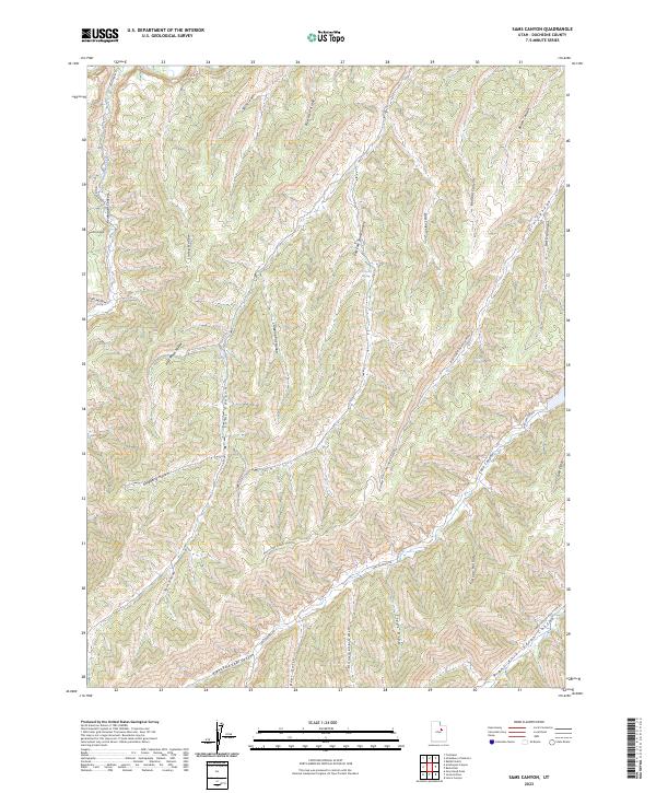
2023 Map of Sams Canyon
USGS Topo · Published 2023About this map
Avintaquin Creek and its surrounding drainages define this portion of Duchesne County, characterized by a complex network of canyons and hollows. The landscape is marked by name-bearing features like Linley Hollow, Hoodoo Canyon, and Bertha Hollow, which suggest a history of local geographic identification by early settlers or ranchers. The drainage patterns are significant, with Sams Canyon and its East Fork Sams Canyon converging amidst the high terrain. Access to this high-country area is facilitated by established routes such as Avintaquin Rd and Lake Canyon Rd, which follow the natural contours of the land. Water sources, vital in this arid environment, are noted at Big Spring, providing a focal point in a landscape otherwise dominated by seasonal washes like Bear Gulch and Monument Gulch.
Find a feature on this map
30 named features on this map. Tap any name to fly to it.
Don’t see what you’re looking for? This feature index may not catch every label — zoom into the map to look around manually.
Map Details
Editions of this 2023 Sams Canyon Map
This is the sole edition of this map. No revisions or reprints were ever made.
Other maps of this area

1885 · Uinta
USGS Topo · 1:250,000

1886 · Price River
USGS Topo · 1:250,000

1896 · Price River
USGS Topo · 1:250,000

1954 · Salt Lake City
USGS Topo · 1:250,000

1956 · Price
USGS Topo · 1:250,000

1958 · Salt Lake City
USGS Topo · 1:250,000

1960 · Salt Lake City
USGS Topo · 1:250,000

1960 · Price
USGS Topo · 1:250,000

1962 · Price
USGS Topo · 1:250,000

1962 · Strawberry Pinnacles
USGS Topo · 1:24,000